Exploration Operations Expanding Resources & Mine Life
DENVER , CO – SSR Mining Inc. reported that the Marigold operations gold production was 34,680 ounces in the first quarter of 2024. As planned, first quarter 2024 results included increased waste stripping to support near-term development activities at Red Dot, which is a key focus for 2024 and 2025. Marigold’s 2024 production remains approximately 70% weighted to the second half of 2024. The Marigold Mine Mineral Reserves support a LOM over 16 years of operational life, including ten years of active mining followed by six years of processing the heap leach pad inventory. Cumulative gold production from the leach pad is equivalent to 70.6% recovery, and total gold recovery, including recoverable gold inventory in the pad, is estimated at 74%.
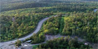
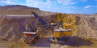
The Marigold Mine is located in Humboldt and Lander County, Nevada, United States on the Battle Mountain-Eureka trend. Marigold has been In production since 1989, Marigold is a large run-of-mine heap leach operation with several open pits, waste rock stockpiles, leach pads, a carbon absorption facility, and a carbon processing and gold refining facility. Open Pit operations at Marigold are carried out using standard open pit mining methods including drilling, blasting, loading, hauling, and dumping to the designated leach pads or waste rock storage areas (WRSA) at the mine. Exploration at Marigold continues to focus on higher-grade oxides, resource expansion and reserve conversion. New Millennium & Buffalo Valley may host potential for longer-term stand-alone processing infrastructure, improving operating costs through shorter hauls.
The gold deposits at Marigold are best characterized as Carlin-type deposits and cumulatively define a north-trending alignment of gold mineralized rock more than eight kilometres long. Gold mineralizing fluids were primarily controlled by fault structure and lithology, with tertiary influence by fold geometry. Within the Valmy Formation, higher gold grades are observed in the hinge zones of open folds that trend west-northwest and plunge gently. When viewed down plunge, the undulation of these folds is mimicked by gold mineralized horizons. The deposition of gold was restricted to fault zones and quartzite dominant horizons within the Valmy Formation and high permeability units within the Antler sequence. The Buffalo Valley gold deposit is a distal disseminated silver-gold deposit and formed along a southeast trending zone of felsic porphyry dikes and faults. Gold occurs in arsenian iron sulfide overgrowths on pyrite in sheeted quartz+sericite+pyrite (QSP) veinlets within the central granodiorite and dacite porphyry dikes, subparallel to dike margins in the country rock, and within faults (e.g., the Front fault). Outboard of the intrusions, gold mineralization is stratiform in receptive horizons of Havallah sequence metasedimentary rocks. Gold mineralization at Trenton Canyon is best described as a Carlin-type deposit and primarily hosted in a network of transtensional faults locally intruded by Eocene dikes and sills. Hydrothermal and/or phreatomagmatic breccias within these structures typically contain increased concentrations of gold. Gold mineralization is well confined to structures, although a small (several meter) halo of lower grade, more disseminated mineralization may be present.
Quartz veining, illite, iron oxides, and iron hydroxides (goethite) are the primary indicators of gold mineralization where oxidized. The Mineral Resources estimates at the Property include the following by deposit area: 1) Marigold: 103.72 million tonnes (Mt) Indicated Resources at an average gold (Au) grade of 0.44 g/t containing 1.47 million ounces (Moz) Au and an additional 19.09 Mt at an average grade of 0.36 g/t Au containing 0.22 Moz of Inferred Resources. 2) Buffalo Valley: 14.89 Mt Indicated Resources at an average grade of 0.57 g/t Au containing 0.27 Moz Au and 8.77 Mt at an average grade of 0.51 g/t Au containing 0.15 Moz in the Inferred category. Gold production data from the leach pad provide the best indicator for future processing recoveries because the ore from 1999 to present has been very consistent metallurgically and mineralogically. Gold recovery from future ore is estimated to be 74.5% based on a review of historical assay and recovery data as well as metallurgical test work on future ore. The gold recovery in each of the four lithologies at Buffalo Valley are dependent on particle size. Recovery by particle size distribution was compiled using the current and historical Buffalo Valley metallurgical test results. The results were used to determine the gold recovery for each material type for resource calculations.
The Marigold Complex includes two main land packages, the Marigold Land Package and the Sterling Land Package, collectively, the Property or project areas. The Marigold Land Package encompasses approximately 10,477 hectares (ha), including the approximately 3,296 ha within the Marigold Mine Plan of Operations (PoO). The Sterling Land Package (9,383 ha) includes properties associated with the Trenton Canyon Mine and Buffalo Valley Mine. The first recorded gold production from the Property near Valmy, Nevada, occurred in 1938 when the Marigold Mining Company, owned by Frank Horton, operated an underground mine which came to be known as Marigold. The Horton family processed approximately 9,000 t of ore averaging about 6.85 g/t Au before World War II halted production. In 1943, Mr. Horton’s estate sold its interest in the Property and claims. Several unsuccessful attempts were made to open and operate the mine before exploration activities began again in 1968. From 1968 through 1985, several companies conducted exploration programs in the Marigold area and completed a total of 126 exploratory drill holes. Records document the activities of Homestake (1968), St. Joe (1979), Decker Exploration (1979), Placer Amex (1979–1980), True North, Marigold Development Company (MDC) (1981–1983), Welcome North (1984), and Nevada North Resources (USA) Inc. (1985–1986). Other groups that conducted work in the area include Newmont, Kerr-McGee, SFP Minerals Corporation, Cordex/Rayrock Mines, and Vek/Andrus Associates (partnership between Vic Kral, Ralph Roberts, Bob Reeve, and Bill Andrus composed of Vek Associates and Andrus Resources Corporation).
The operating partner Cordex, an exploration syndicate composed of Dome Exploration (U.S.) Ltd., Lacana Gold Inc. (Lacana) and Rayrock Mines, leased the Vek/Andrus Associates claim block in September 1985 and began a drilling program in November 1985. Drill holes NM-3 and NM-4 intersected 21.3 m of 2.40 g/t Au and 25.9 m of 7.54 g/t Au, respectively. These were the discovery holes for the 8 South (8S) ore body. Following further drilling in the 8S deposit in the spring of 1986, a joint venture was formed between SFP Minerals and the Cordex group, which consolidated some of the land holdings over the Marigold area.
In late-1986, the Cordex group leased other claims, including the historical Marigold mine, Mackay (Top Zone, East Hill, and Red Rock) area from various claim holders. In March 1988, Rayrock Mines (operating company for Cordex) made a production decision on the 8S deposit, and, by September 1988, it began stripping on the 8S pit (McGibbon, 2004). In August 1989, the first gold doré bar was poured at the Marigold mill. In March 1992, Rayrock Mines purchased a two thirds ownership interest in the Property, and Homestake Mining Company (Homestake), which had taken Lacana’s interest through previous corporate mergers, held the remaining one third ownership interest in the Property. In 1994, mining of the 8S deposit was completed, and the Marigold mill was no longer used to process ore. At this point, Marigold became a run-of-mine (ROM) heap leach operation. In March 1999, Glamis Gold Ltd. (Glamis Gold) purchased all the assets of Rayrock Mines, resulting in Glamis Gold holding a two thirds ownership interest in Marigold, and Homestake continuing to hold a one third ownership interest. By January 2001, a total of one million ounces of gold had been recovered from the Property. In 2006, Glamis Gold merged with Goldcorp Inc. (Goldcorp), resulting in a Goldcorp subsidiary holding a two thirds ownership interest in Marigold and being the operator. Homestake, which had been acquired by Barrick Gold Corporation (Barrick) in 2001, continued to hold the remaining one third ownership interest. In 2007, discovery holes were drilled in the Red Dot deposit. On April 4, 2014, SSR (formerly Silver Standard Resources Inc.) completed the acquisition of Marigold from subsidiaries of Goldcorp and Barrick. In August 2015, Marigold mine acquired 2,844 ha of adjacent land from Newmont. This land included previously mined areas known as the Mud pit, NW pit, and the Valmy pits. Exploration drilling in the area had been completed by a combination of companies including Hecla Mining Company (Hecla), SFP Minerals, and Newmont.
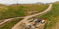
In June 2019, SSR acquired the Trenton Canyon and Buffalo Valley properties from Newmont Goldcorp Corporation (Newmont). The Trenton Canyon target is located approximately four kilometres south of New Millennium and the Buffalo Valley target is located approximately 10 km southwest of New Millennium. Both properties are included in an 8,900 ha parcel that is contiguous to the south boundary of the Marigold property Marigold is located in the Battle Mountain district of north-central Nevada within the Basin and Range physiographic province bounded by Sierra Nevada to the west and the Colorado Plateau to the east. Paleozoic basement rocks of north-central to north-eastern Nevada generally comprise four distinct tectonostratigraphic assemblages: the eastern carbonate assemblage; the slope or transitional assemblage; the western siliceous and volcanic assemblage; and the overlap assemblage (Roberts, 1964). These rocks record a complex history of compressional and extensional tectonics and magmatism affecting the western margin of North America from the early Paleozoic through present. The Battle Mountain district hosts numerous mineral occurrences, including porphyry copper–gold, porphyry copper–molybdenum, skarn, placer gold, distal disseminated silver-gold, and Carlin-type gold systems. Since acquiring the Property in April 2014, SSR has conducted several surface exploration programs including soil sampling, geophysics, and in-fill/delineation drilling. Reverse Circulation (RC) and Core (Diamond Drilling-DD) drilling on the Property is the principal method of exploration and delineation of gold mineralization after initial targeting using soil sampling and geophysical surveys. Drilling can generally be conducted year-round on the Property. As of the effective date of this TRS, SSR and its predecessor companies have completed over 2.4 million metres of drilling in 12,636 drill holes across the Marigold, Buffalo Valley, and Trenton Canyon areas.
Since 2022, exploration at the Property has focused on the following: 1) Exploration drilling to expand Mineral Resources and Mineral Reserves through systematic step out drilling. 2) Infill drilling to increase the confidence of Mineral Resource estimates, specifically targeting areas with widely spaced drilling (approximately 35m to 50 m) and around drill holes drilled prior to 2006 with missing assays. 3) Drilling to confirm the final position of the pit highwall. 4) Defining mineralization at Trenton Canyon and Buffalo Valley. From December 1, 2021, through to the end of June 2023, a total of 491 holes have been drilled (456 RC holes and 35 diamond core holes), totalling 139,839 m. The Marigold Complex is owned directly by SSR’s wholly-owned subsidiary, Marigold Mining Company (MMC). The open pit heap leach gold mine has been in production since 1989 and has produced over four million ounces of gold.
Related Posts